
For iPhone and iPad · version 2.0 of flightControlRP
Race day, on one screen.
Liberate the birds and SimpleFlight Pigeon tells you the distance to the loft, when to expect the first bird from the wind along the line of flight, and what weather is between the birds and home. When they land, the speed in YPM. If you clock with BENZING Live, arrivals land in the app as they happen.
Free. No account, nothing leaves your phone. Requires iOS 18 or later; BENZING Live arrivals need iOS 27. Yards or metres.
How it works
From liberation to the first bird
Built by a fancier who wanted the numbers without a laptop in the loft.
Set the loft and stations
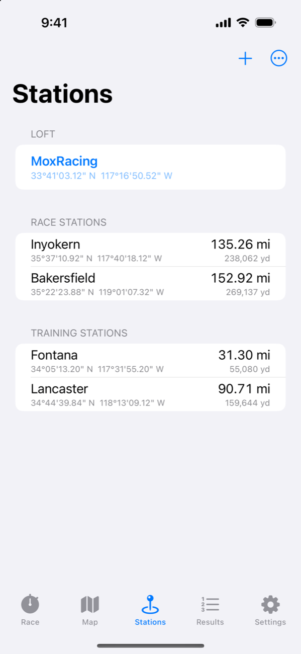
Drop a pin, use your location, or type the club's coordinates in degrees-minutes-seconds. Distances are computed to the yard on WGS-84, and the club's official distance wins when you enter it.
Start the race
Pick the station and the liberation time, or tap Toss from here at a training release. Coming from flightControlRP? Your stations come with you.
Watch them fly
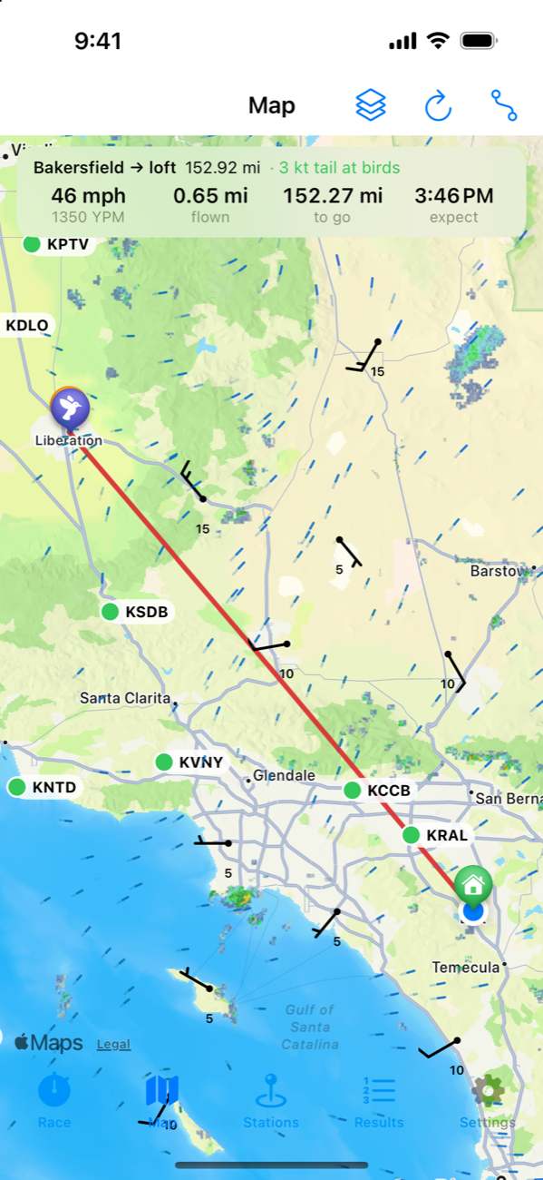
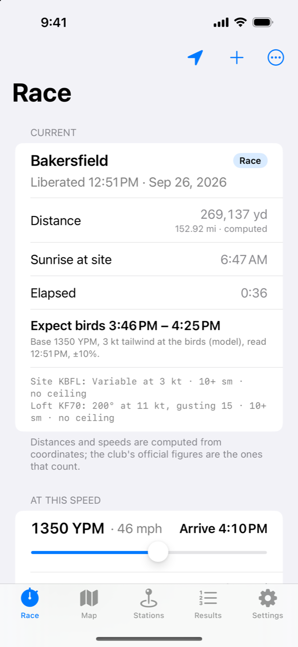
Slide to the speed you think the birds are making and see the arrival time, miles flown and miles to go. The bird on the map moves with it. The expected window follows the wind the birds are actually in.
Clock them in
Record each band by hand, or let BENZING Live's notifications record them for you. YPM per bird, minutes behind the first, and a race card to share.
Features
What Benzing doesn't do
Your clock knows when the birds landed. This app is about everything before that.
Wind along the line
The tailwind or headwind component along the line of flight, from the reporting stations and the surface wind model, and an arrival window that recomputes every minute from where the birds are.
Weather ahead of the birds
Every reporting station between the birds and the loft, with rain, low cloud, poor visibility, strong headwind or gusts flagged, and how many miles ahead it is.
YPM and the slider
Yards per minute for any arrival time, the fine-tune slider from the original app, and mph for a speed you can picture. Metres per minute and km/h if you prefer.
Radar, satellite, animated wind
The SimpleFlight weather map with the line of flight drawn on it. Long-press anywhere to make it a station.
BENZING Live arrivals
A Shortcuts automation on your phone hands each BENZING Live notification to the app, which records the band and clock time on the current race. No account, no password, nothing leaves the phone. Needs iOS 27 or later.
Results and sharing
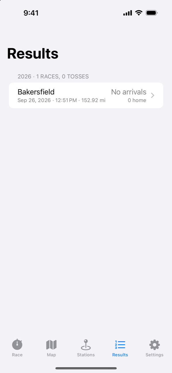
Races and tosses by season with every arrival, a race card image for the club chat, CSV import, and a link to your MyPigeons race page.
A look inside
Real screens, live weather
For fanciers
Straight answers
- Is the expected arrival a prediction? No. It is arithmetic: an assumed speed (1,350 YPM until the app has your own results), adjusted by half the wind component along the line, shown as a ±10% window with the wind and base it used. Your birds will tell you how good it is; the base learns from your first-bird speeds.
- Are these official distances? They are computed from coordinates with the same WGS-84 formula the clubs use, but your club's published distance is the one that counts. Enter it on the station and the app uses it for every speed.
- Does it connect to my BENZING clock or MyPigeons? Not directly; BENZING does not offer that to other apps. Arrivals reach the app through the notifications BENZING Live already sends you, via a Shortcuts automation you set up once (this needs iOS 27 or later; the rest of the app runs on iOS 18). Setup steps are in the app. Digitier is not affiliated with BENZING or MyPigeons.
- I had flightControlRP. This is its version 2.0, from the same developer. Update it from the App Store and your loft and stations come across. Your old speed calculations still work the same way.
- What about my data? There is no account and no server. Loft, stations, races, arrivals and band numbers stay on your device. Weather requests go to public weather services with the map area only. See the privacy policy.
- What does it cost? Nothing. Digitier, LLC makes it, in Riverside, California; the developer flies with the WOC Wing Over CA RPC.

Also from SimpleFlight: SimpleFlight Planner, VFR flight planning for pilots, on the same map and weather.