
Coming to iPhone and iPad
VFR flight planning, simply.
Pick where you're going. SimpleFlight answers the questions that matter before a VFR flight: how far, how long, how much fuel, what the weather is doing along the way, what airspace is in the way, and what the destination looks like when you get there.
One email when the TestFlight beta opens and one at launch. See the privacy policy.
How it works
Four steps from idea to briefing
Built by a pilot who wanted the answer on one screen, not spread over six apps.
Set up your airplane
Cruise speed, fuel burn, usable fuel, the altitude you usually fly. Once, then it's remembered.
Pick a destination
Type an identifier or a city. Press and hold the route line to bend it around airspace; it snaps to airports, VORs and fixes nearby.
Choose an altitude
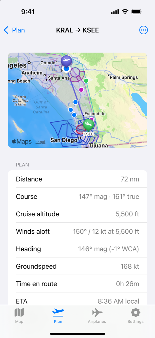
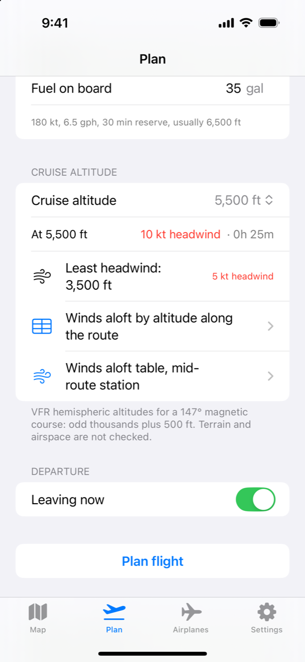
Only legal VFR hemispheric altitudes are offered, each with its headwind or tailwind and time en route from the current winds aloft.
Read the plan
Heading, groundspeed, time, fuel and reserve, weather at every reporting airport along the way, airspace, TFRs, advisories and PIREPs. Then send it to Garmin Pilot.
Features
Everything a VFR flight needs, nothing it doesn't
US only and VFR only, on purpose. That focus is what keeps it simple.
Winds aloft that move
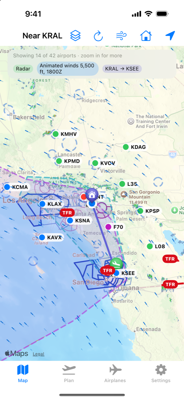
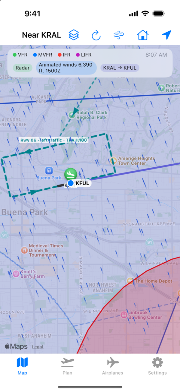
An animated wind layer at your cruise altitude, plus the full winds-aloft table for 6, 12 and 24 hours.
Weather along the route
Decoded METARs and TAFs for airports in the corridor, colored by flight category, with radar and satellite on the map.
Airspace at your altitude
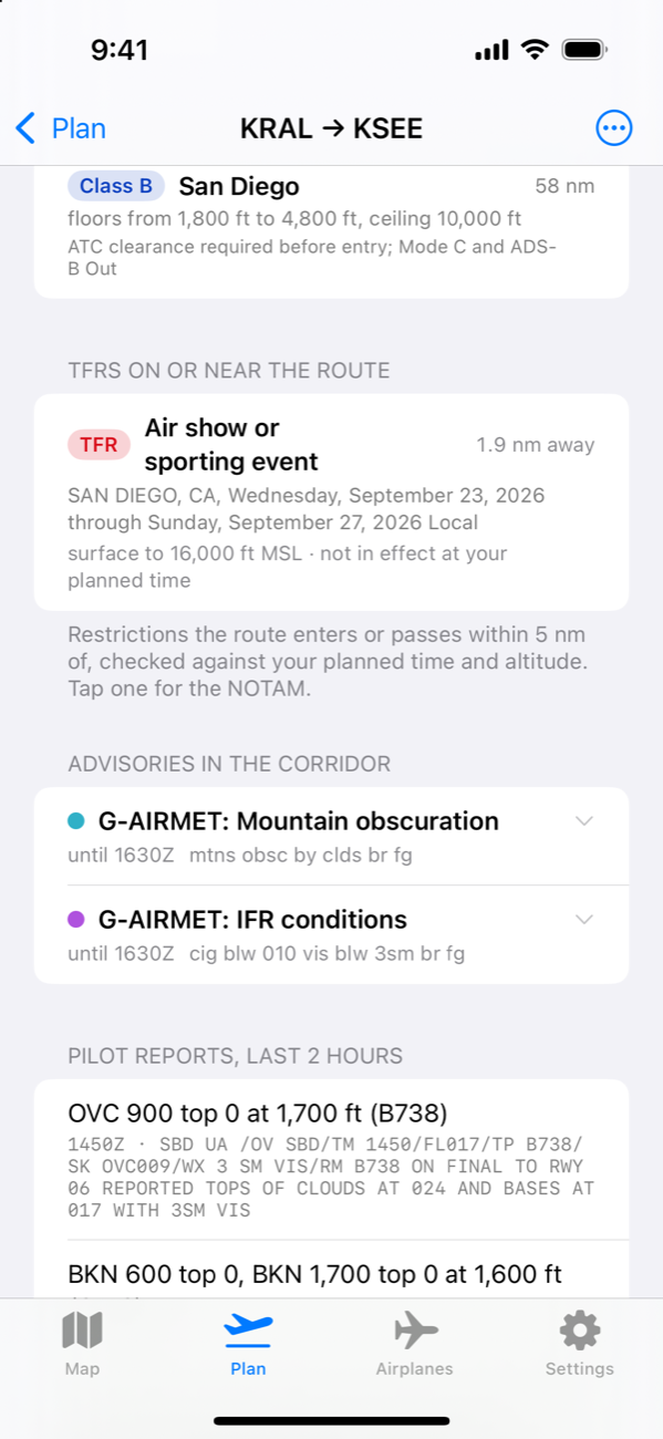
Class B, C and D shelves with floors and ceilings. Shelves that apply at your cruise altitude stand out; the rest fade back.
TFRs, SIGMETs and PIREPs
Restrictions on or near your route, checked against your planned time and altitude, with the NOTAM text a tap away.
Runways and the pattern
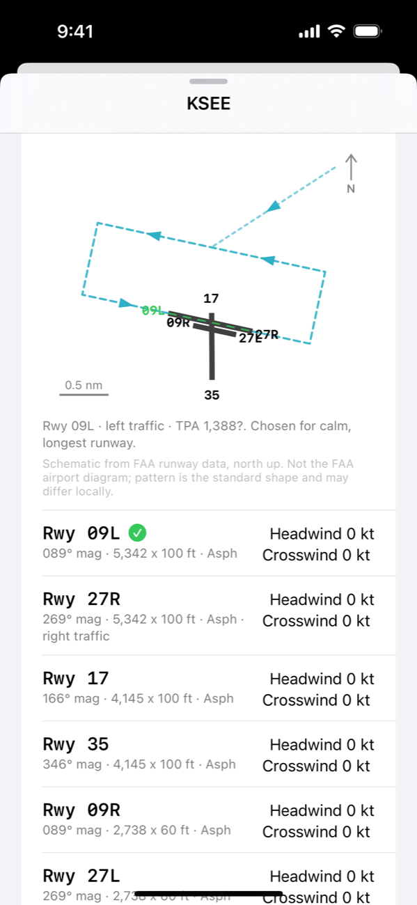
Headwind and crosswind for every runway, a to-scale runway diagram, and the expected traffic pattern drawn on the map for the wind right now.
Hand off to Garmin Pilot
Share the route as a Garmin FPL file, waypoints included, and fly it on the avionics you already trust.
A look inside
Real screens, live data
Captured from the app with live weather. Nothing here is a mock-up.
For pilots
Straight answers
- Does it replace a briefing? No. SimpleFlight shows you data and does the arithmetic. It never tells you a flight is safe. You are pilot in command: get an official briefing, check NOTAMs, and use current charts.
- Where does the data come from? Weather from the Aviation Weather Center. Airports, runways, frequencies, navaids and airspace from the FAA. TFRs from tfr.faa.gov. Radar and satellite from the Iowa Environmental Mesonet. Wind fields from the GFS model via Open-Meteo.
- IFR? Outside the US? Not now. It is a VFR planner for the United States, and saying no to the rest is what keeps it fast to use.
- What about my data? Today everything you enter stays on your device. Optional accounts are planned so your airplanes and plans can follow you between devices; the privacy policy says exactly what that will involve.
- What will it cost? Pricing will be announced before launch. Early-access pilots hear first.
- Who makes it? Digitier, LLC, a technology studio in Riverside, California. It's built by a pilot based at KRAL.